
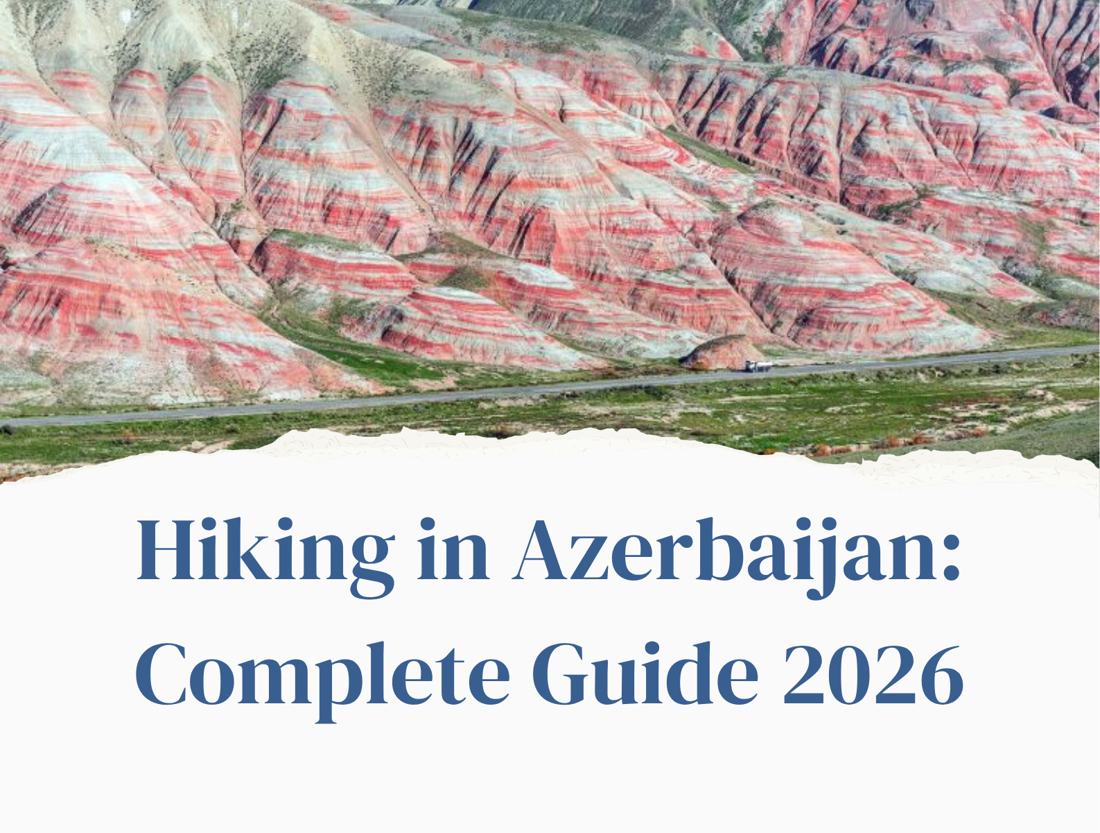
Azerbaijan doesn’t promote itself as a hiking destination – and that, ironically, is one of the best things about it. While thousands of foreign hikers visit neighboring Georgia’s trails each season, Azerbaijan’s mountain paths are still mostly unexplored, uncrowded, and really untamed. The Greater Caucasus stretches across the north of the country with peaks reaching 4,400 meters. Ancient villages perch at altitudes where clouds pass at eye level. Eagles fly above high ridges where the only noises are the wind and distant sheep bells.
Our blog Hiking in Azerbaijan: Best Trails, Tips & Complete Guide 2026 covers the greatest hiking sites and trails in Azerbaijan, from short waterfall hikes to challenging multi-day treks between distant Caucasus communities, and includes practical information on difficulty, duration, altitude, and how to get there.
Before Hiking in Azerbaijan: What You Should Know About Trails
Azerbaijan’s hiking infrastructure is still in development. The majority of trails are unmarked, waypoints are scarce, and English-language information is limited in comparison to Georgia. This is not a reason to avoid trekking here; rather, it is a reason to be adequately prepared.
⚠️ Essential Planning Notes
|
The Best Trails for Hiking in Azerbaijan
-
Galakhudat to Khinalug
📍 Quba District, Greater Caucasus
| Distance
~8 km one way |
Duration
3-4 hours |
Max Altitude
2,270 m |
Difficulty
Easy |
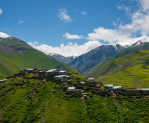
One of the most rewarding walks in the country and one of the most accessible. The trail begins from the village of Galakhudat and follows a wide mountain path with continuous views of the pale Gizilgaya cliffs, the green Gudyalchay river valley, and the towering peaks of Bazarduzu (4,466m) and Shahdag (4,243m). It ends at Khinalug, one of the oldest and highest continuously inhabited villages in the Caucasus, inscribed on the UNESCO World Heritage List in 2023.
Highlights:
- Khinalug village itself – 5,000 years of history, unique Ketsh language spoken nowhere else on earth
- Panoramic views of the Greater Caucasus ridge throughout the walk
- Arrival into the village from above – the stone houses tiered down the mountain slope
- Traditional tea in Khinalug’s small tea house after the walk
💡 Tip: Do this as a one-way walk – arrange a car from Quba to Galakhudat at the start and have transport waiting in Khinalug at the end. The road to Galakhudat and Khinalug requires an SUV.
-
Khinalug to Laza Trek
📍 Quba District, Greater Caucasus
| Distance
~18-22 km |
Duration
6-8 hours |
Max Altitude
~3,000 m (pass) |
Difficulty
Hard |
The most demanding and spectacular trail in Azerbaijan is a high-alpine crossing from Khinalug (2,350m) over a mountain pass to the settlement of Laza (1,650m), located between the Gizilgaya and Shahdag plateaus on the banks of the Gusar River. On clear days, the trail spans broad highland meadows and scree fields, with views far into Russia’s northern Caucasus from its highest point. Laza is home to a small Lezgin community with several guesthouses.
Highlights:
- International travelers rarely experience high-alpine terrain.
- Crossing from one ethnic community (Khinalug people) to another (Lezgins of Laza)
- Eagles and wild horses frequently seen along the ridge
- One of the few trails in Azerbaijan that truly seem like true wilderness
💡 Tip: This trail is for experienced hikers only. A guide is strongly recommended – conditions on the pass can change rapidly. Plan to stay overnight in Laza rather than attempting the full route as a day hike.
-
Laza to Kuzun
📍 Quba/Gusar District
| Distance
~12 km |
Duration
3.5 hours |
Max Altitude
1,650 m start |
Difficulty
Moderate |
A lovely medium-difficult track that descends from Laza village via different terrain – forest sections, open meadows, and river crossings — to the lower village of Kuzun. The walk winds through the Gusar River valley, providing constant mountain vistas. This is a wonderful choice for hikers looking for a full day out without the exhausting demands of the Khinalug-Laza traverse.
Highlights:
- Dense forest sections with rich birdlife.
- Clear river crossings with a mountain backdrop.
- Far fewer hikers than Khinalug trails, resulting in true isolation.
💡 Tip: Combine with an overnight in Laza, where the guesthouse food is outstanding, with lamb and locally grown herbs. Make arrangements for pickup in Kuzun ahead of time.
-
Shahdag National Park Trails
📍 Quba/Gusar District
| Distance
Varies (5–25 km) |
Duration
2-8 hours |
Max Altitude
Up to 4,243 m |
Difficulty
Easy-Hard |
Azerbaijan’s largest national park includes a significant area of the Greater Caucasus and has paths for all skill levels, from casual subalpine meadow hikes to the challenging ascent of Shahdag peak itself (4,243m), which requires mountaineering experience and suitable equipment. For the majority of visitors, the park’s allure falls somewhere in the middle: day walks through crystal-clear lake basins, past secret caverns, and through landscapes rich in wildflowers and unique species. The park is home to several endangered species, including the Caucasian leopard, but sightings are extremely rare.
Highlights:
- The park’s interior features stunning alpine lake basins
- One of the few places in the South Caucasus where Caucasian leopard tracks have been recorded
- Shahdag Mountain Resort offers cable car access to higher elevations
- Wildflower meadows at their peak in May-June
💡 Tip: The national park access requires a permit, which can be obtained from the park visitor center. Hire a certified guide and plan on spending at least two days acclimatizing before attempting the Shahdag summit.
-
Tufandag Mountain Trails
📍 Gabala District
| Distance
5-15 km |
Duration
2-5 hours |
Max Altitude
~2,200 m |
Difficulty
Easy-Moderate |
Tufandag is best known as Azerbaijan’s top ski resort in the winter, but in the summer, its routes lead through extraordinarily beautiful Greater Caucasus landscapes, including dense woodland, wide meadows, and high ridgelines with lengthy views across Gabala’s verdant valleys. The resort’s contemporary cable car system allows hikers to ascend fast and then descend at their leisure, making it the most accessible mountain trekking choice in Azerbaijan for guests who are not experienced trekkers.
Highlights:
- With cable car access, hikers can start high and go down, making it ideal for families and beginners
- Rich flora, including endemic Caucasus plant species
- Spectacular views of the Gabala valley and the Greater Caucasus ridge.
- The resort’s mountain swing is a memorable (and terrifying) bonus
💡 Tip: Tufandag is only 2.5 hours from Baku, making it the most accessible mountain trekking day trip from the capital. Combine with a wine tasting at one of Gabala’s wineries on the way home.
-
Mount Niyal from Lahij
📍 Ismayilli District
| Distance
~10-12 km return |
Duration
4-5 hours |
Max Altitude
~2,100 m |
Difficulty
Moderate |
Lahij is one of Azerbaijan’s most picturesque towns, a medieval coppersmith town with riverstone-paved streets and artists working in traditional workshops. The mountain trip to Mount Niyal above the hamlet is an excellent combination of cultural experience and actual mountain walking, beginning in a wonderfully preserved medieval town and ascending into open highland terrain with views back over the red-roofed buildings and the canyon below.
Highlights:
- The village of Lahij – picturesque ancient village in Azerbaijan
- Open mountain terrain with views of the Ismayilli valley
- Combines well with the Gabala wine area, about 45 minutes away by vehicle
💡 Tip: Lahij’s coppersmith workshops are worth an hour before or after the trek; the metalwork here has been created in the same style for generations and provides a unique keepsake.
-
Quba to Griz Village Trek
📍 Quba District
| Distance
~20 km |
Duration
Full day (7-8 hours) |
Max Altitude
~2,000 m |
Difficulty
Hard |
A difficult full-day walk from the outskirts of Quba across different mountain landscape to the isolated village of Griz, which sits at over 2,000 meters altitude and is home to a small ethnic population with its own unique customs and language. The route passes through lush forests, high meadows, and steep mountain routes. The result is an intimate experience with a village that sees few international visitors – and the story of the Griz people, who speak a South Caucasian language related to Lezgic, is as captivating as the beauty.
Highlights:
- Explore a culturally rich village in Azerbaijan that has yet to be seen by tourists.
- Explore diverse terrain including woodland, meadow, ridge, and distant settlement in one day.
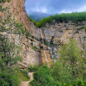
- The Griz Waterfall along the path transforms into a stunning ice grotto during winter
💡 Tip: This trail is not well marked – a local guide from Quba is needed. We will be happy to arrange the trek for you.
-
Gobustan Day Hikes
📍 Gobustan District (near Baku)
| Distance
3-8 km |
Duration
1-3 hours |
Max Altitude
~300 m |
Difficulty
Easy |
Not a mountain hiking location, but the most accessible hiking region from Baku and truly unlike anything else in the Caucasus. Gobustan National Park, located about 60 kilometers south of Baku on the Caspian coast, combines ancient rock art (petroglyphs going back 40,000 years, designated as a UNESCO site) with a surreal landscape of mud volcanoes – Azerbaijan has more mud volcanoes than any other country on Earth. The topography is low, dry, and Mars-like, in stark contrast to the forested Caucasus north.
Highlights:
- Gobustan’s rock art is one of the world’s most prominent prehistoric art locations.
- The mud volcanoes in the Caucasus are unique, with seething gray methane cones and chilly mud.
- Easy access from Baku, making it a good half-day trip.
- Discovered fossilized seabed landscapes from when the Caspian Sea was much larger
💡 Tip: Visit in the morning before the midday heat in summer, as the landscape is exposed. Combine with a visit to the Gobustan Museum for valuable context on the rock art.
-
Zagatala & Northwest Forest Trails
📍 Zagatala District
| Distance
Varies |
Duration
2-6 hours |
Max Altitude
~1,500 m |
Difficulty
Easy-Moderate |
The northwestern part of Azerbaijan, around Zagatala, is the country’s most thickly forested region – a scene of beech, hornbeam, and chestnut forest draped across the southern slopes of the Greater Caucasus, considerably different from the stark high ridges of the Quba region. Zagatala Nature Reserve protects the area and provides walking trails through ancient woodland, with a good chance of seeing brown bear, lynx, and a variety of birds. The region also has various multi-ethnic settlements, as well as the distinct Avar and Tsakhur communities.
Highlights:
- Dense ancient forest walks – the richest biodiversity of any hiking area in Azerbaijan
- Brown bear, lynx, and wolf all present (very rarely seen but tracks are found)
- Multi-ethnic villages with distinct cultures: Avars, Tsakhurs, and Georgians all live in this region
- Zagatala trout farm – a unique agritourism stop nearby
💡 Tip: Zagatala is 4-5 hours by vehicle from Baku but only 2 hours from Sheki; combine the two for a very rewarding northwest Azerbaijan trip.
-
Candy Cane Mountain Trails
📍 Altiaghaj area, Quba-Baku Highway
| Distance
2-5 km |
Duration
1-2 hours |
Max Altitude
~500 m |
Difficulty
Easy |
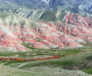
Not a difficult hike, but one of the most visually stunning little walks in Azerbaijan. The Candy Cane Mountain area near Altiaghaj village is made up of rolling hills with stunning horizontal bands of red, orange, pink, and white clay — the vibrant colors generated by layers of iron mineral compounds exposed by progressive erosion. Several short trails lead through the formations. Look closely at the ground as you walk and you might spot fossilized belemnites — prehistoric squid-like creatures from when this entire area was a seabed.
Highlights:
- The most photographed natural landscape in Azerbaijan after Baku
- Prehistoric sea fossils visible on the rock surface
- Perfect stop on the Baku-Quba Road, adding less than 2 hours to the journey
- The crimson colors are especially striking in the late afternoon light
💡 Tip: Bring water and snacks as there are no facilities available. The formations are visible from the road, allowing you to assess the conditions before committing to the hike.
Hiking Areas at a Glance
| Region | Best For | Difficulty | From Baku | Best Season |
| Quba / Khinalug | Mountain culture, remote villages | Easy-Hard | ~3 hours | May-Oct |
| Shahdag NP | Alpine scenery, wildlife | Moderate-Hard | ~3.5 hours | Jun-Sep |
| Tufandag (Gabala) | Accessible mountain hiking | Easy-Moderate | ~2.5 hours | May-Oct |
| Lahij / Ismayilli | Culture + hiking combo | Moderate | ~2 hours | Apr-Nov |
| Zagatala (NW) | Forest, biodiversity | Easy-Moderate | ~4.5 hours | May-Oct |
| Gobustan | Day hike, rock art | Easy | ~1 hour | Oct-May |
| Candy Cane Mtns | Short scenic walk, photography | Easy | ~2 hours | Year-round |
What to Pack for Hiking in Azerbaijan
Essential Gear
- Use sturdy hiking footwear with ankle support for Azerbaijani paths with rough pebbles and uneven ground.
- Bring a waterproof jacket as mountain weather can change quickly, especially in the summer.
- Download offline maps on your phone (Maps.me and AllTrails offer Azerbaijan routes).
- Use more water than expected, as springs are not always reliable.
- Provide sun protection due to high UV exposure at altitude.
- Use a warm layer for evenings and passes, as temperatures drop significantly over 2,000 meters.
- Bring a small quantity of cash (Azerbaijani Manat) for accommodations, tea houses, and guides.
Recommended for Multi-Day Treks
- Tent and sleeping bag – wild camping is permitted across Azerbaijan
- Trekking poles – particularly useful on loose scree above 2,500m
- First aid kit including blister treatment and altitude headache medication
- Emergency whistle and headlamp
- Printed map as backup – do not rely solely on phone GPS in remote areas
📱 Useful Apps for Hiking in Azerbaijan
|
Should You Hire a Guide?
For trails in the Quba region, Shahdag National Park, and anywhere off established routes, the answer is yes – at least for your first visit. Azerbaijan’s trails are not marked the way European hiking trails are. Paths can be overgrown, forks unmarked, and weather windows narrow. A local guide adds safety, cultural context, and often access to hospitality that independent hikers miss entirely.
For visitors combining hiking with a broader Azerbaijan or Caucasus itinerary, our team at Caucasus Trip can help arrange guided mountain day trips or multi-day treks as part of a private tour.
→ Contact us to arrange a guided hiking experience in Azerbaijan
Best Time to Hike in Azerbaijan
- May–June (Recommended)
The best overall hiking season. By mid-May, most passes had been cleared of snow. Wildflowers are at their peak, with the alpine meadows above Khinalug and Shahdag National Park blanketed with color. Days are long, temperatures are agreeable, and rivers are full of snowmelt. The waterfalls are at their most beautiful.
- September–October (Excellent)
The second-best season. The summer heat has departed, the sky are calm and stable, and the forests in the northwest (Zagatala, Sheki) have turned golden and red. The days are slightly shorter, although visibility is often better than in the spring. The apple harvest in Quba is a bonus because the orchards near town are in full production.
- July–August (Hot but Viable)
Summer is a popular season for Azerbaijani domestic tourism, and the mountain areas are especially busy. Higher elevations remain comfortable, but lower trails and approach roads can get hot. Begin early. Midday temperatures in the Candy Cane Mountain area can be quite high.
- November–April (Limited)
Mountain roads to Khinalug and many other trailheads are closed or unreliable from late November through April due to snow. This season, Shahdag National Park and Tufandag operate as ski resorts. Gobustan and low-altitude treks around Baku are accessible year-round.
Hiking in Azerbaijan vs Georgia: How They Compare
Georgia is the more developed hiking destination in the Caucasus, boasting better-marked trails, more international information, and a longer history of adventure tourism. If you’re planning your first Caucasus hiking trip and want infrastructure and obvious route markings, Georgia – notably Svaneti and Kazbegi – is the better option.
Azerbaijan rewards bold travelers. The routes are calmer, the settlements are more distant, and the cultural encounters – arriving in Khinalug, trekking to Griz, walking through Zagatala’s ethnic mosaic – often feel deeper because fewer people have done them. On a combined Caucasus itinerary, the two nations work extremely well together.
Combining both countries? See our Georgia hiking guide and our multi-country Caucasus tours.
Frequently Asked Questions — Hiking in Azerbaijan
Do I need a permit to hike in Azerbaijan?
Most trails are freely accessible without a permit. Shahdag National Park requires an entry permit, available at the park visitor center. For trails very close to the Russian border, there may be restricted zones – check with a local guide before heading into unfamiliar territory in the far north.
Is it safe to hike alone in Azerbaijan?
Solo hiking is possible on well-known routes like Galakhudat–Khinalug, but for more remote trails like Khinalug–Laza, Quba–Griz, a guide is genuinely recommended for safety. The main concerns are not personal security (the mountains are very safe in that regard) but navigation, weather, and the remoteness of the terrain if something goes wrong.
Can I hike in Azerbaijan without speaking Azerbaijani?
In trailhead villages and guesthouses, very little English is spoken. Download the Azerbaijani language pack on Google Translate for offline use. A few basic phrases (hello: salam, thank you: çox sağ ol, water: su) go a long way. A guide solves the language barrier entirely.
What wildlife might I see?
In Shahdag National Park and Zagatala: brown bear, lynx, wild boar, and the rare Caucasian leopard (extremely rarely seen). Golden eagles and other raptors are common throughout the mountains. Wild horses roam high ridges near Khinalug. The Gobustan area has large flocks of migrating birds in spring and autumn.
Are there mountain huts or refuges on Azerbaijan’s trails?
Not in the European alpine sense. Most multi-day hikers stay in village guesthouses (widely available in Khinalug, Laza, and Lahij) or wild camp. Come prepared for camping if you plan to hike between villages – don’t rely on finding accommodation along the trail itself.
Plan Your Azerbaijan Hiking Trip
Azerbaijan’s mountains are one of the most underrated hiking destinations in the world. From the UNESCO-listed village of Khinalug perched above the clouds to the ancient forest trails of Zagatala, from the psychedelic Candy Cane formations to the demanding ridge crossings of the high Caucasus – there is a trail here for every level of ambition.
The key is preparation: a good car, an offline map, and where possible a local guide who knows these mountains as home.
→ Read our complete Quba & Caucasus Mountains guide
→ Explore Azerbaijan tours with Caucasus Trip
→ Contact us to plan a guided hiking itinerary
About Caucasus Trip
Caucasus Trip is a family-run travel agency based in Tbilisi, Georgia, specializing in private tours, car rentals, and tailor-made experiences across Georgia, Armenia, and Azerbaijan.

Comment (0)